
You know that vague, unsettling feeling that something big and ugly is being built just outside your town but nobody's really telling you about it? Turns out, for a lot of Americans, that feeling is 100% justified - and now there's a map for it.
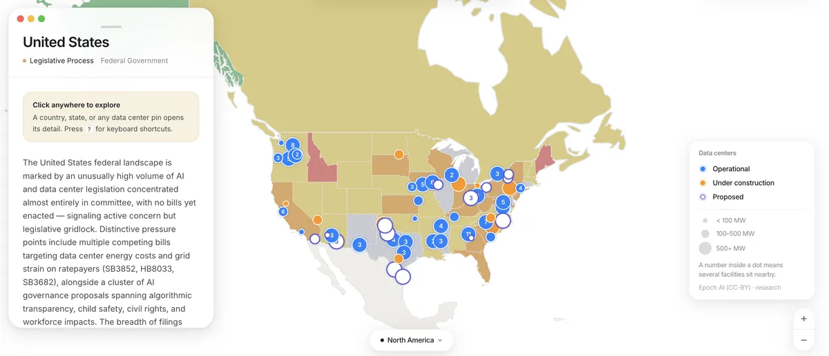
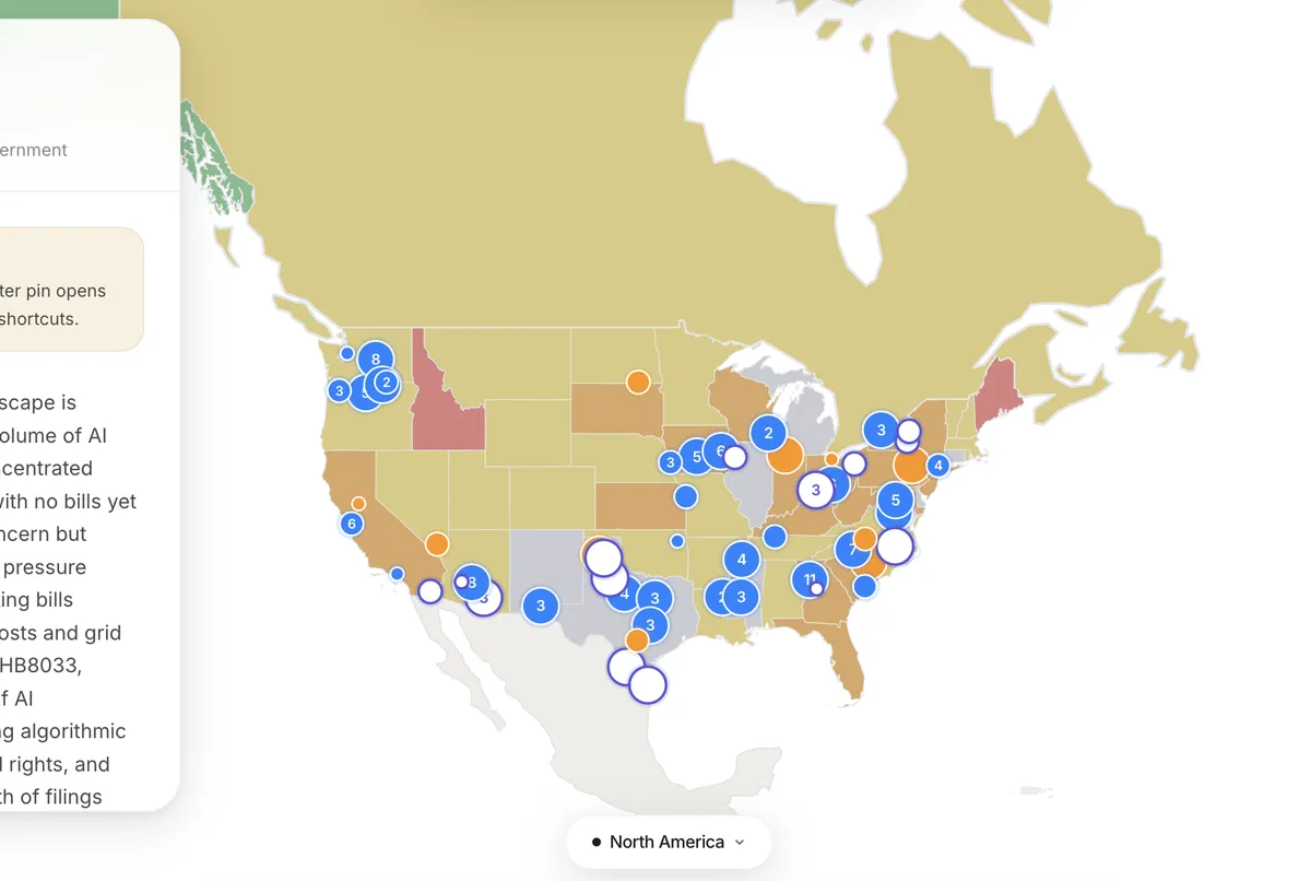
Oregon resident Isabelle Reksopuro built an interactive map tracking data center construction and AI infrastructure policy across the country, and honestly it's the kind of thing that makes you go "wait, how did this not exist already?"

The origin story is very relatable
It started when Reksopuro heard that Google was reportedly gobbling up public land in her home state to expand its data center footprint. Classic villain origin story stuff. But here's where it gets genuinely interesting - she wasn't sure what to believe. "There's a lot of misinformation about data centers," she told The Verge. "Google has denied taking that land."
The reality, as she explains it, is complicated. The city of The Dalles - a town near the Washington state border - had sought to reclaim certain land, with Google being a key player in the situation. Which is exactly the kind of nuanced, easy-to-misrepresent story that spreads like wildfire online without anyone ever really understanding it.
So instead of just being mad on the internet (the default setting for most of us), Reksopuro built a tool to actually track what's happening and where.
Why this matters more than you think
Data centers are quietly becoming one of the most consequential pieces of infrastructure in modern life. They drink water. They eat electricity. They reshape local land use and policy. And they're sprouting up at a frankly wild pace to feed the AI boom that every tech company is currently losing its mind over.

The problem is that most people have absolutely no idea where these things are being built, what deals were made to put them there, or what that means for their community. Local news is stretched thin. Policy documents are buried. And tech companies are not exactly tripping over themselves to explain their land acquisitions to curious neighbors.
That's the gap this map fills. It's not just a dot-on-a-map situation - it also tracks AI policy developments, giving you a clearer picture of the regulatory landscape surrounding all this construction.
One person with a laptop did this
Let's take a moment to appreciate that a single Oregon resident, frustrated by misinformation and a lack of clear information, just went ahead and built a useful public resource. That's genuinely impressive. According to The Verge, the tool is interactive and designed to help people understand what's actually happening in their backyards.
If you've ever wondered why your electricity bills are climbing, why certain counties suddenly have very strong opinions about zoning law, or why "AI infrastructure" keeps showing up in local planning documents - this map might finally give you some answers.